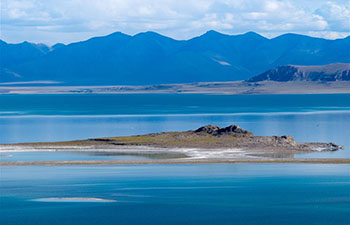
BEIJING, Sept. 25 (Xinhua) -- Chinese scientists have used satellite imagery to investigate illegal sand dredging activities in Hongze Lake located in Jiangsu Province.
Hongze Lake is the fourth largest freshwater lake in China. As it has a bountiful supply of sand that can be used in construction, illegal sand mining activities are rampant. These mining activities destroyed the lake's original ecological environment and bottom structure.
Many sand dredging vessels hide during the day and work at night, making conventional monitoring measures ineffective. Scientists from Nanjing Institute of Geography and Limnology under Chinese Academy of Sciences used both daytime and nighttime satellite data to evaluate the dredging intensity and the associated aquatic environmental effects.
The research provides technological support for government monitoring and the control of illegal sand dredging activities.
This method is being promoted and applied in other lakes across the country. The research was published in the journal Science of the Total Environment.